Teilen:
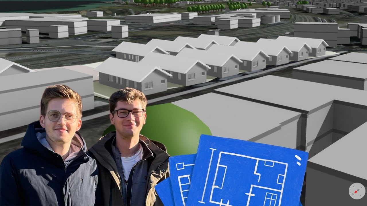
When students in the civil engineering program at HTWG Konstanz tackled an interdisciplinary project brief — designing a temporary housing complex for 100 asylum seekers on a vacant brownfield site — sunlight was not just a comfort consideration. It was an engineering requirement. Winter solar exposure, summer heat protection, and PV system feasibility all depended on getting the building orientation and spacing right from the start. To do that, they turned to Shadowmap Studio.
The Project Brief: Designing Housing with the Sun in Mind
As part of the interdisciplinary project module (IPRO) of their Bachelor's degree in Civil Engineering at HTWG Konstanz, students Erik Tschentscher, Johannes Lewedey, and Max Zinsmaier were asked to collaboratively plan a fictional residential complex in the winter semester of 2024/25. The site: a real brownfield plot near the LAGO shopping centre in Konstanz, Germany. The goal: accommodate up to 100 people in adequate living quarters.
Their scope included structural engineering, site planning, and building physics — covering wall construction, moisture protection, heating system design, summer thermal protection, and solar energy potential. Accurate sunlight planning was embedded in nearly every discipline they were working across.
Why Sunlight Planning Is a Core Engineering Task
In building physics and structural engineering, sunlight analysis is rarely optional. The orientation of a building determines how much direct solar radiation it receives through winter months — a key input for heating load calculations. In summer, the same orientation governs solar heat gain and the need for shading or insulation to prevent overheating. And for any building where a photovoltaic system is considered, the irradiance falling on roof and facade surfaces must be calculated against shadows cast by neighbouring structures, trees, and terrain.
For the HTWG team, all three of these challenges were present — and the spacing between individual buildings on the site was a critical variable. Place the units too close together, and winter shadows from adjacent structures would block solar access entirely. Too far apart, and the site could not accommodate all residents within the available footprint.

How the Students Used Shadowmap Studio
IFC Import and Real-World Site Placement
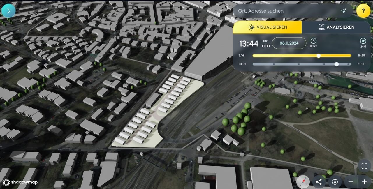
The students imported their 3D building model directly into Shadowmap Studio as an IFC file — one of the most common formats in structural and architectural workflows, supported by tools like AutoCAD, Revit, and ArchiCAD. The IFC model was placed precisely on the actual Konstanz brownfield site using Shadowmap's map-based positioning, giving the project immediate real-world geographic context.
This step alone replaced a significant amount of manual calculation. With the model embedded in its actual location, the local topography, surrounding buildings, and true solar angles were all factored in automatically.
Building Orientation and Spacing for Winter Solar Access
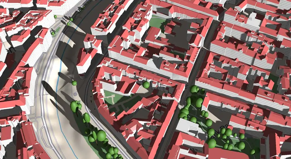
With the site model live in Shadowmap Studio, the students could simulate shadow patterns for any date and time of year. For their winter sun study, they focused on the sun's low-angle path during December and January — the most demanding months for solar access in Central Europe. By visualising how shadows fell across the proposed building arrangement at key times of day, they were able to determine the minimum spacing between structures that would guarantee adequate sunlight in each unit throughout winter.
The timelapse animation feature — which simulates the sun's movement across a full day as a frame-by-frame sequence — made it straightforward to review shadow behaviour over time rather than sampling individual moments. The result informed both the orientation of each building and the inter-building distances used in the final site layout.
Solar Irradiance Analysis for Heating and PV Planning
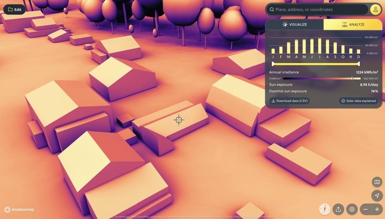
Beyond shadow casting, the students also used Shadowmap Studio's solar irradiance data to quantify how much solar energy would reach the building surfaces, taking into account the surrounding existing structures. This data directly fed into two downstream tasks: determining the heating concept for the residential units and sizing the photovoltaic installation that would supplement the building's energy supply.
Rather than relying on simplified irradiance tables or generic regional averages, the team worked with site-specific 3D solar data that reflected the actual shading context of their design. According to the students, this significantly simplified what would otherwise have been a time-consuming manual calculation process.
Student Feedback: Intuitive, Comprehensive, and Immediately Useful
The students reported that Shadowmap Studio was easy to get started with, noting that the interface was clear and intuitive enough to navigate without onboarding time. They praised the visualisation settings — covering rendering quality, graphics, camera controls, and map types — as more than adequate for the level of detail their academic project required.
The ability to simulate the sun position for any day of the year and any time of day — and to run these simulations as animated timelapses — was specifically highlighted as a feature that left no gaps in their analysis workflow. For a student team working across multiple engineering sub-disciplines simultaneously, having a single tool that covered shading studies, orientation analysis, and solar irradiance in one place was a meaningful efficiency gain.
"The program itself is structured very well and intuitive, so we were able to navigate it easily right away."
— Erik Tschentscher, Johannes Lewedey & Max Zinsmaier, 6th semester Civil Engineering, HTWG Konstanz
Sunlight Planning Across Academic Disciplines
The use case from HTWG Konstanz is one example within a much broader field of academic applications where sunlight and shadow analysis plays a foundational role. Across disciplines, the need to understand how the sun interacts with designed or natural environments is both a pedagogical requirement and a research imperative.
Architecture and Urban Design
In architecture programmes, sun studies and daylight analysis are standard components of studio coursework. Students designing residential buildings, public spaces, or mixed-use developments are expected to evaluate how their proposals affect solar access for neighbours and occupants alike — and to demonstrate compliance with daylighting standards. Shadowmap Studio supports this with IFC and OBJ import, real-site placement, and the ability to share interactive 3D sun studies with reviewers on any device.
Urban Planning and Public Realm Studies
Urban planners studying the impact of new development on street-level sunlight, public park access, or the pedestrian environment use shadow analysis as a key tool in their impact assessments. 3D shading studies allow planners to evaluate proposals across seasons and to communicate their findings visually to non-technical stakeholders.
Landscape Architecture and Garden Design
For landscape architects and horticultural researchers, knowing which areas of a site receive direct sun versus shade at different times of year is essential for plant selection, irrigation planning, and outdoor space design. Solar access studies on real terrain — accounting for surrounding trees, topography, and structures — are directly applicable to field and studio work in these programmes.
Environmental Science and Ecology
Environmental researchers studying habitat quality, urban heat island effects, or the microclimate impact of built structures need accurate solar radiation data at a site-specific level. Shadowmap's global 3D solar dataset, covering terrain, vegetation, and building geometry, provides a research-grade foundation for fieldwork preparation, data collection, and grant proposal support.
Energy Engineering and Building Performance
As the HTWG case study illustrates, energy engineering students working on building performance, renewable energy systems, or passive design strategies rely on precise solar irradiance data to make credible calculations. Whether sizing a PV array, modelling heating loads, or assessing thermal mass performance, the quality of the underlying sunlight data has a direct effect on the accuracy of the engineering outcome.
Shadowmap Studio for Academic Projects
Shadowmap Studio is built for professionals, but structured to be accessible to students from the first session. Its combination of real-world 3D data, flexible model import (OBJ, FBX, DAE, IFC, GLB), and browser-based sharing makes it well suited for coursework, seminars, research projects, and academic competitions.
Academic discount codes and subscription options are available for university email addresses. Sponsorships for student competition teams and grant proposal support for research projects are also offered.
Learn more about Shadowmap for Academia — including academic discounts, demo requests, and sponsorship options — at shadowmap.org/academia.
Diesen Artikel teilen:
MEHR ERFAHREN
Erhellende Einblicke




BEKANNT AUS